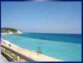
GeographyThe Dominican Republic, “the miniature continent”, is located in the center of the Caribbean and is one of the most important air and maritime communication routes worldwide. The country occupies the eastern two thirds of the island, between the parallels 18º and 20º. In the west the country borders Haiti. To the North, beautiful gold sand beaches border the Atlantic Ocean. In the south, the island is surrounded by the bright blue Caribbean Sea waters. Finally, on the East side it has the Mona Channel. The country has an area of 48,442 Km2 and has 32 provinces: 31 municipalities and one district, the capital Santo Domingo, where 35% of the population resides. These provinces are grouped into three large regions and six sub-regions in accordance with climate and cultural differences: the Northern or Cibao Region, the Southwestern Region and the Southeastern Region. The island has five major mountain ranges, among which the “Cordillera Central,” located in the northern region, dominates the others and contains the highest mountain of the Antilles: “Pico Duarte” (3,087 meters above the sea level).   |
  |


